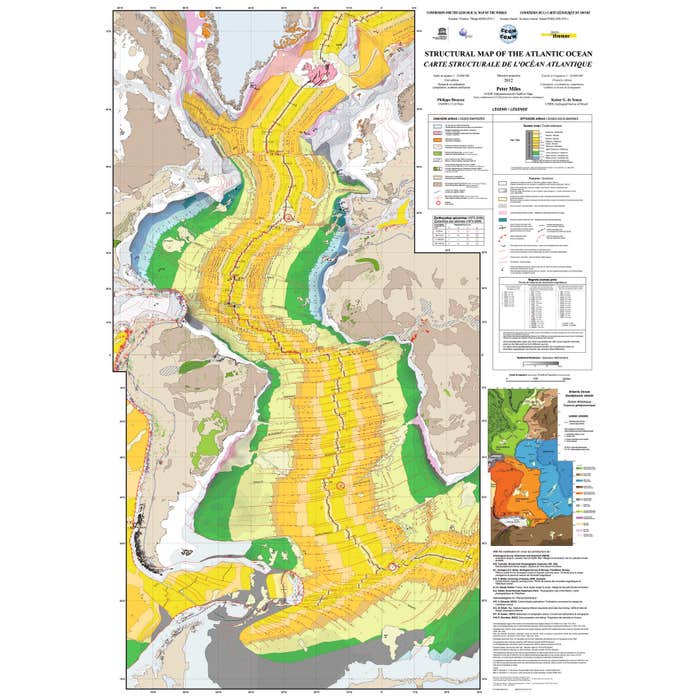
Format: 119 x 84 cm
Scale: 1/20,000,000th
Production: CCGM
Structural Map of the Atlantic Ocean
Sku: 375170
CCGM
€32.80
€39.36
The main, structural map represents the ocean and the surrounding continents with their simplified structural features. In the oceanic domain, the following elements are represented:
• Age of the oceanic crust, by epochs
• Positions of standard magnetic anomalies (or 'chrons'), where they have been measured or interpreted
• Active and fossil oceanic spreading axes
• Transform faults and fracture zones
• 'Abnormal' submarine relief and subduction zones
• Sequences of oceanic reflectors sloping towards the ocean (SDRs)
• Epicenters of earthquakes and depths of foci
• Hotspots
• Sites of deep-sea drilling (DSDP, IPOD, ODP, IODP) where the substratum or transitional crust has been reached
• Thickness of sediments, isopachs being drawn on the oceanic crust or on thinned continental crust sectors
• Oceanic crustal deformation zones
• Representation of continental geology elements related to the opening of the Atlantic Ocean
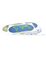
The structural map is accompanied by a Geodynamic Sketch and a Physiographic Map. These two additional documents show the arrangement of the lithospheric plates covering or surrounding the Atlantic domain, the morphology of the whole, as well as the toponymy of a number of underwater structures mentioned in the text.
| Caractéristiques techniques |
- In stock
- In stock
- In stock
-
There are 58 product(s) left in stock
-
In stock