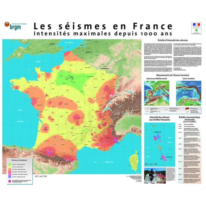
Format: 88 x 73 cm
Scale: 1/2,000,000
Production: BRGM
Earthquake Map in France: Maximum Intensities
Sku: 817093
BRGM
€11.90
€14.28
This map shows the spatial distribution of earthquakes, with the most violent intensities felt in metropolitan France over the past 1000 years (scale 1/2,000,000) and those felt in the French West Indies from 1700 to 2004 (scale 1/1,850,000).
|
Caractéristiques techniques
|
- In stock
- In stock
- In stock
-
In stock

-
In stock

- In stock